
5th Grade - Changes in Landforms & Oceans
Instructions: Students, complete the portion your teacher assigns.
Read the info in black. Write the info in brown in your science journal.
Read the info in black. Write the info in brown in your science journal.
|
|
5.E.3A.1
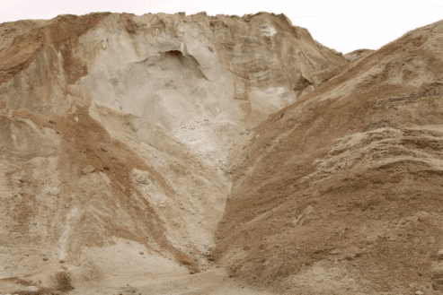
A watershed (drainage basin) is the land that water flows over or through before reaching a lake or river. Water can be any form of precipitation such as rain, snow, sleet, or hail. Frozen precipitation melts becoming liquid water. Each basin is sectioned off by what is called a water divide which is a high area of land such as a hill, or mountain. Each landform affects the path of the watershed. Watersheds can be large, or small, and large basins are made up of many smaller basins. Water from streams flows downward (due to gravity) and meets with other water flows, gaining enough volume to become creeks and rivers. These moving bodies of water eventually flow to ponds, lakes, or the ocean. The downhill movement of water as it flows to the ocean changes the shape and appearance of the land through the processes of weathering, erosion, and deposition.
A watershed (drainage basin) is the land that water flows over or through before reaching a lake or river. Water can be any form of precipitation such as rain, snow, sleet, or hail. Frozen precipitation melts becoming liquid water. Each basin is sectioned off by what is called a water divide which is a high area of land such as a hill, or mountain. Each landform affects the path of the watershed. Watersheds can be large, or small, and large basins are made up of many smaller basins. Water from streams flows downward (due to gravity) and meets with other water flows, gaining enough volume to become creeks and rivers. These moving bodies of water eventually flow to ponds, lakes, or the ocean. The downhill movement of water as it flows to the ocean changes the shape and appearance of the land through the processes of weathering, erosion, and deposition.
2014 SC Science Support Document
|
|
As you watch this intro video, pause the video to sketch your best understanding of a watershed. Be sure to label your sketch. Think...what creeks, rivers, lakes, oceans have you visited? What creeks, rivers, lakes are in our area, and how are they connected? |
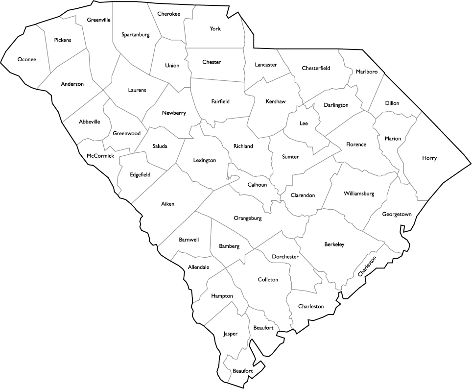
Printable SC Map
|
SC Watersheds
Your Assignment: 1. Either sketch in your notebook, or print and paste the map into your notebook, a SC map. 2. Go to the SC Dept. of Health and Environmental Control's page on SC Watersheds. 3. On your map, draw in the watershed basin outlines. Label each basin. 4. Click on the Catawba River Basin. Read the basin description. Write a bulleted list of what you learn about this basin. |

|
5.E.3A.2
|
|
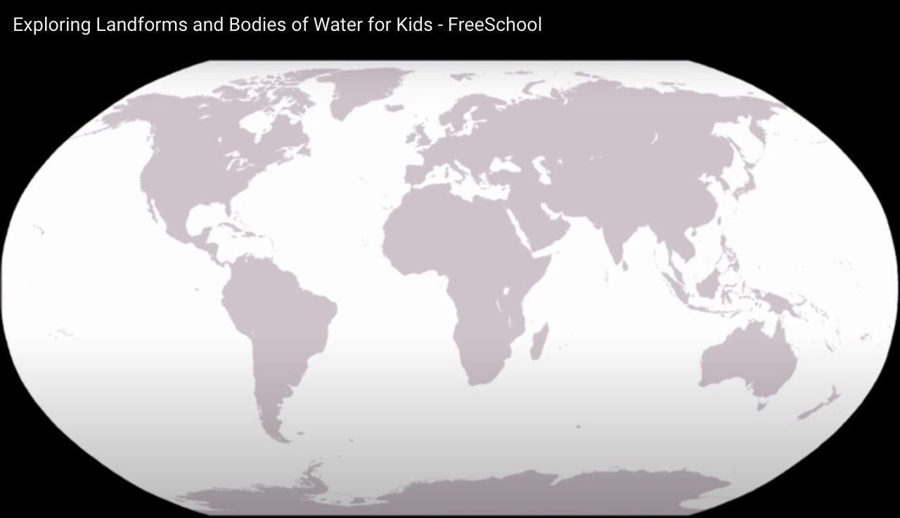
Sketch this diagram of the earth in your notebook. Print if you prefer. Label the 7 continents and the 5 oceans as you watch the video.
|
As you watch the rest of the video:
1. Trace a circular object to make a pie chart showing the amount of the Earth that is ocean vs land.
2. Smaller landforms are created by ________ and _________.
3. New land may be created by ________ or _________.
4. Make a chart with a section for each of the following. In the chart, write a brief description and draw a small sketch. A section for an example may also be helpful.
|
Mountains
Hills Valleys Volcanoes Islands Peninsulas Isthmus Bay Coral Reef |
Lagoon
Estuary River (fresh) Ocean (salt) Pond (fresh or salt?) Lake (salt or fresh?) Plains Plateaus Canyons |
In the video, you learned that some bodies of water contain fresh water, while others contain salt water. Why? What causes bodies of water to be salty? Do some research to answer these questions.
Maybe you can find some items around your house to make a model of some of the landforms you
learned about in the video. Check out the models for some inspiration.
learned about in the video. Check out the models for some inspiration.
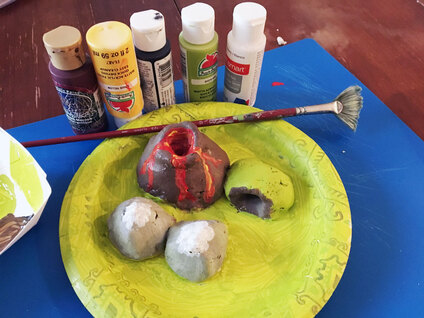
Image from: https://sciencedemoguy.com/ngss-2-ess2-2-science-activity/
|
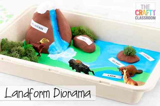
Image from:
https://thecraftyclassroom.com/crafts/geology-crafts-for-kids/landform-diorama-craft/
|
5.E.3B.1 How natural processes affect earth's surface
Many 5th grade teachers will have their class set up stream tables. Watch this video demonstration of a stream table. While you watch write down 5 things you can learn from this setup, and 5 questions you have about erosion, deposition, and landforms based on what you see in the video.
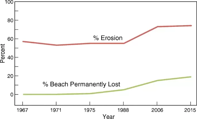
Graph is from
https://link.springer.com/article/10.1007/s10584-018-2327-7#Fig7
|
Study the graph, answer the questions in your notebook. 1. How many years are covered by this graph? 2. In this time span, was there ever more beach permanently lost than erosion? Why does this make sense? 3. Through the whole time period, about how much more erosion was there than permanent loss? 4. Overall, has erosion increased or decreased? 5. What are some reasons you might note for the rise in the graph on the right? |
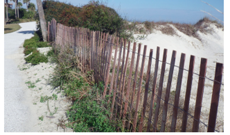
5.E.3B.3 Conservation Efforts
Conservation scientists have developed many different ways to control and monitor erosion. Several are pictured below. For each picture, write or discuss with your classmates how this method would be effective.
Conservation scientists have developed many different ways to control and monitor erosion. Several are pictured below. For each picture, write or discuss with your classmates how this method would be effective.
|
|
Images above from
https://gaswcc.georgia.gov/sites/gaswcc.georgia.gov/files/imported/SWCC/Files/2016%20Field%20Manual%20for%20Erosion%20%26%20Sediment%20Control.pdf
https://gaswcc.georgia.gov/sites/gaswcc.georgia.gov/files/imported/SWCC/Files/2016%20Field%20Manual%20for%20Erosion%20%26%20Sediment%20Control.pdf
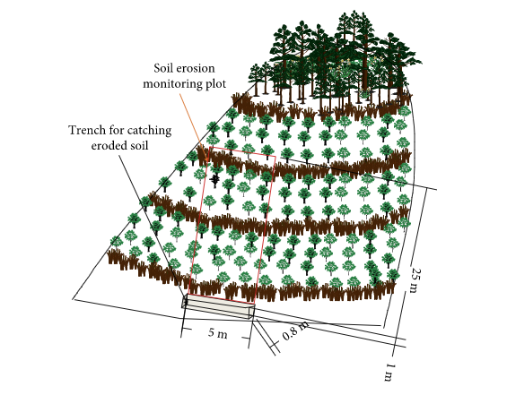
Image from
https://www.hindawi.com/journals/aess/2018/2397265/
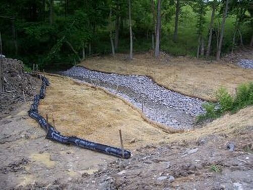
Image from
https://stormwater.pca.state.mn.us/index.php?title=Erosion_prevention_practices_-_Riprap
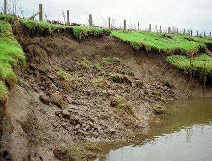
Image from
https://gabion1.com/gabion-erosion-control/
|
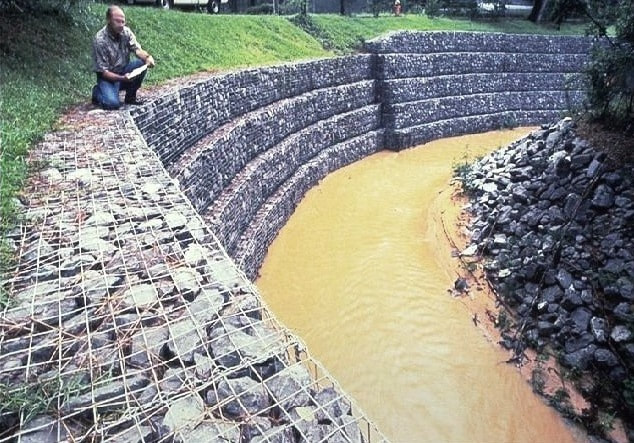
Image from
https://gabion1.com/gabion-erosion-control/
|
What methods to control erosion could you develop?
